
The iGUIDE PLANIX camera system is revolutionizing the way real estate is documented and shared. With its ability to capture accurate 3D virtual tours and 2D floor plans in just minutes, it offers a powerful tool for real estate professionals, architects, and interior designers.
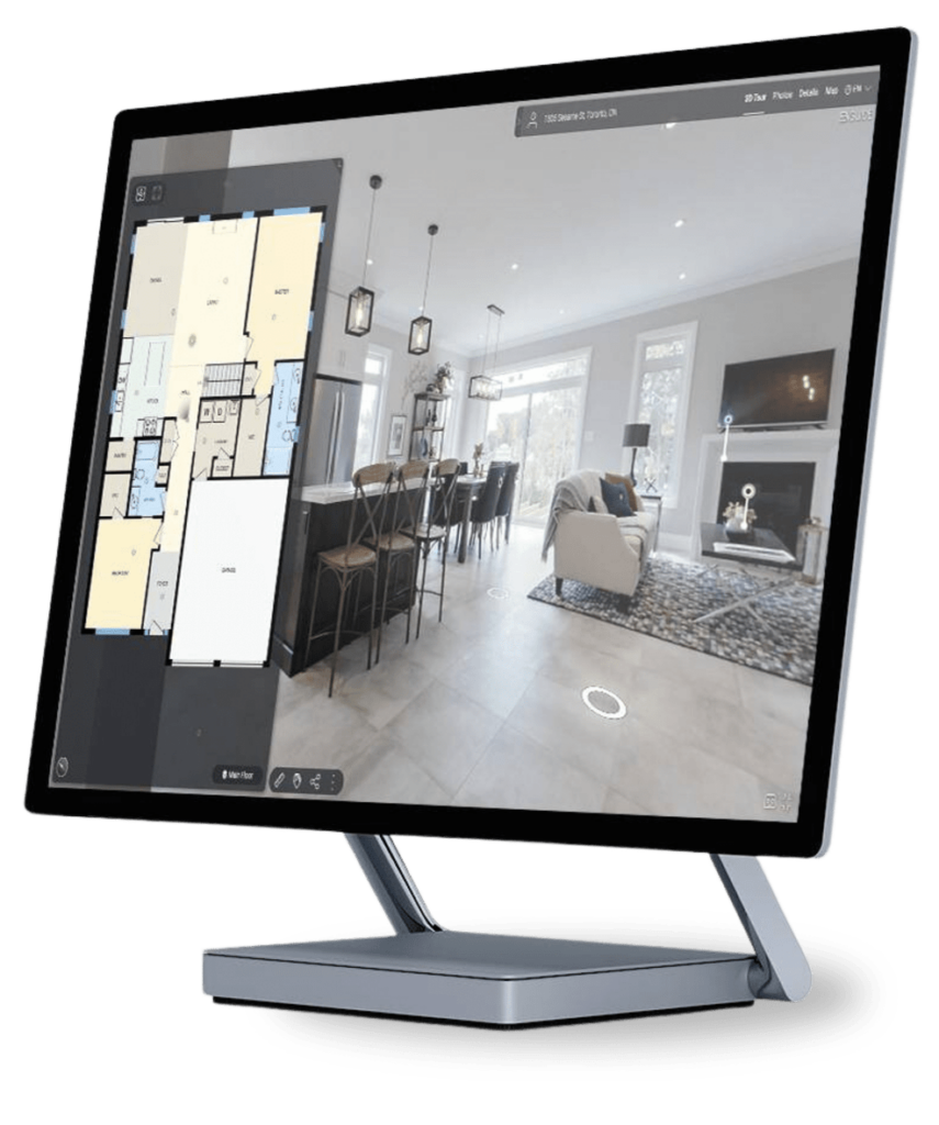
The system’s immersive 3D tours provide a lifelike experience, allowing viewers to virtually walk through a space and explore its layout and design. This not only enhances the viewing experience for potential buyers or clients but also saves time and resources by reducing the need for physical visits.
In addition to the 3D tours, the iGUIDE PLANIX system offers accurate lidar measurements within 0.5% ANSI-Z765-2021 standards. This level of precision ensures that the measurements are reliable and can be used for various purposes, such as space planning, renovations, or property assessments.
Furthermore, the system generates 2D floor plans that are detailed and to scale, providing a clear visual representation of the space’s layout. These floor plans are essential for understanding the spatial relationships within a property and are valuable for both marketing and design purposes.
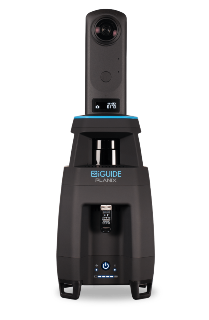
Measure, document and photograph a space simultaneously! Using a 360° time-of-flight lidar scanner with accuracy exceeding industry standards.

Converts PLANIX camera
data into iGUIDE 3D virtual tours, including accurate floor plans, 360° images, room dimensions, photos and more.